World Geography
Grade Seven
Mr. Pitts-Dilley
Course Overview:
The primary goals of this course is to use geography as a tool to have students improve their English and Spanish skills in the four language domains: speaking, listening, writing and reading and at the same time improve the students high order thinking skills. The students will also learn about the different cultures and traditions of the world and make connections between problems faced by different regions and nations (past and present) in a critical way. However, due to their limited exposure to the English language,
Students are expected to show language progress in both English and Spanish and are not expected to master the Geography Alive curriculum.
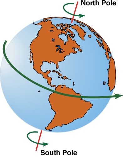
As I say this, I must remind the administration, parents, students and myself that we have high expectations for all children. We cannot wait five to seven years for the students to learn enough English so they can start learning social studies, science, math and literature content. Students will have the master the relative location of all continents and oceans, major seas and countries, learn how to use essential map components such as a map scale and map legend, learn how to use six different thematic maps such as political and economic activities maps and be exposed to the main ideas of human geography.
Students will not be expected to memorize random facts. Instead, students will be expected to read, write, infer, analyze, discuss, and debate how history and geography impact people’s lives. This course focuses on human and physical geography of modern Latin America, Africa, Europe, Asia, Asia, Australia, and Antarctica. Students will leave seventh grade having improved their proficiency in English and appreciation for world, history, geography and cultures. This class is structured utilizing the “workshop” approach to teaching and learning. Within this model, students and teacher will learn and teach each other about history and geography as process that affects people’s daily life such as poverty, who gets and does not get opportunities such as an education, sexism, racism, treatment of minorities, spatial inequality, immigrants and non-citizens, peasants, and war, global warming and climate and natural challenges and not as an abstract system of copying thematic maps and geographic terms.
Content objectives-World Geography:
By the end of the school year students will be able to:
• Locate the seven continents and four oceans.
• Identify the tools used by geographers.
• Identify how to read maps and make use of mental maps
• Identify the difference in between absolute and relative locations
• Identify how petroleum is formed, what causes earthquakes (tectonic plates), how the water cycle functions and the theory of the super continent (Pangea)
• Analyze the magnitude of global warming, spatial and social inequality, immigration, poverty, pollution and deforestation.
• Identify and locate the geography of each continent: major nations, capitals, bodies of water, and landmasses, population density, vegetation and social issues.
• Compare and contrast how immigrants, women, ethnic and religious minorities, and non-citizens are treated world wide
• Analyze how different countries deal with population growth (positive & negative)
• Analyze how different countries of the world deal with population density
• Identify how humans adapt to environment
• Identify how humans change their environment (for better or worse)
• Analyze how different countries deal with religions and ethnic conflicts in heterogeneous nations
• Analyze the importance of major rivers and analyze the pros and cons of hydro electrical power
• Identify how to interpret maps and graphs and use such information to support debate
Language Objectives:
By the end of the school year students will be able to:
• Read, mark text, use graphic organizers and begin to develop the idea that we must read for a purpose
• Identify strategies such as outlines and web organizers to make notes
• Identify how to use technology in the classroom
• Identify how to use internet and library research appropriately (no plagiarism)
• Read aloud and discuss what we read using visuals to help reading comprehension and copy notes as a class
• Listen, Speak, discuss and debate important issues in both English and Spanish
• Improve key vocabulary (sight words) in both English and Spanish.
• Learn how to use graphic organizers such as Venn diagrams and T-Charts to help students write complete sentences and short paragraphs.
• Use PowerPoint, Microsoft Word and other digital and non-digital technologies to show how much the students have learned
• Use the Internet and class blog to show how much the students have learned and use computer reading programs to assist with reading and phonics development
• Each student will improve their own English language proficiency level in the four domains: reading, writing, listening and speaking
• Use the Spanish to foster English language development
Products & Behavior Outcomes:
• Students are expected to read and respond to a do now question every day
• Students are expected to answer critical thinking questions every day
• Students are expected to keep a well organized notebook (with teacher’s assistance)
• Students will complete several projects throughout the school year
• Students will take city wide midterm and final and show improvement
• Students will participate orally and in writing everyday in English and Spanish
• Students will work as a team everyday
• Students will become better citizens
• Students will improve their English proficiency so they can succeed in high school and beyond
• Students will develop a greater appreciation for a bicultural and bilingual United States and multicultural and multilingual world
Approximate Pacing Guide:
September, October, November:
• Setting up the notebook
• Introduction to the class rules & routines
• Introduction to technology, note making & the class website
• Geography Tools: How to use thematic map & how to read maps
• Latitude & Longitude
• Latin American Map Challenges
• Spatial Inequality, Rural decline, immigration, Indigenous Populations (Mayas), Adapting to the land & weather
• Amazon Basin, México Plateau, Panamá Canal, Caribbean Sea, Pampas, Atacama Desert, Andes Mountains
• Midterm
December:
• European Map Challenges
• European Union, pollution, Soviet Union & post Cold War Russia
• Iberian Peninsula, Black Sea, Alps, Scandinavia, Mediterranean Sea, Ural Mountains, Siberia, Rhine River, Danube River
• African Map Challenges
• Hydro electrical power, Water Cycle, Adapting to the land & weather, Sexism, diversity, and racism
• Sahara Desert, Nile River, Mediterranean Sea, Red Sea, Lake Victoria, Lake Chad
• Christmas Break Review Package for the final exam: December 24th to January 2nd
January (Due to the fact that this class I a half year class and the students have a limited exposure to the English language we will complete the map challenges and lightly expose the students to the main ideas of Southwest Asia (Middle East), Monsoon Asia and Australia and Antarctica):
• Southwest (Middle East) & Central Asia Map Challenges
• Poverty, War, Oil resources, and how humans adapt to changes (natural & human made) to the environment
• Arabian, Black, Red, Mediterranean, Caspian and Aral Seas, Persian Gulf, Tigris & Euphrates Rivers (Mesopotamia), and Zagros Mountains
• Monsoon Asia Map Challenges
• Adapting to Monsoons, comparative advantages, Time Zones, protecting the environment, population growth & population density challenges, hydroelectric power and globalization
• Indian Ocean, Pacific Ocean, Bay of Bengal, Yellow Sea, Sea of Japan, Hong Kong, Mt. Everest, Gobi Dessert, and Plateau of Tibet.
• Oceania & Antarctica Map Challenges
• Adapting to the environment & Global warming
• Antarctica, Lake Eyre, Indian Ocean, and Western Plateau
• Review & Final
Classroom Preparation:
• Students should come to class everyday and on time and ready to work.
• They are required to have their Social Studies Interactive Notebook and pencils and/or pens with them at all times.
• I expect all students to become familiar with the rules and regulations provided for them by the school (Scholars Program) and Boston Public Schools.
Homework:
Homework for this class is given almost daily. The purpose of homework is to emphasize the objectives and goals that are presented in class each day. Students who complete homework on a regular basis will most likely pass the class and get prepared for social studies classes in later middle school years, high school and beyond.
Teacher Conference:
I am available nearly every day to meet students before and after school in my homeroom (208). Parents may meet with me any day. I am here to work with you so that your child leaves the Curley ready for a successful career in high school and college. I request that parents make appointments to meet with me when I am not teaching a class; however, I understand that the world that we live today is very fast pace and that parents may have more than one job. Although I encourage parents to set up conference times, I have an open door policy.
Class Website & Grades:
All homework and other assignments, class announcements and helpful resources can be found at http://www.curleyhistorypage.blogspot.com/
You can check your child progress by going to www.snapgrade.net
A password for parents will be provided during October’s 16th Open House
Snap grades gives you the opportunity to monitor your child’s work on a day by day basis!!!
You can also email any questions or concerns to
ppittsdilley@boston.k12.ma.us
You can also reach the Curley School at
617-635-8176
Grading:
Numerical and letter grades will be used. Remember that this is a half year class only. Students cannot afford to do poorly in the first term.
• Formal writing assignments, tests, and quizzes account for 20% of a student’s grade each quarter.
• Homework: 25% of a student’s grade each quarter.
• Notebook: Notebook taking is the task that most incoming high school students do not complete well. Your child will leave the Curley with the ability to take good notes, which is essential for high school and college. The notebook is 20% of s student’s grade each quarter.
• Class participation: This is a course, which focus on personal responsibility, leadership, group work and character. Students who do not contribute positively to the class will not pass this course regardless of work. No\ child has the right to affect another child’s right to a quality public education due to his or her behavior.
• Online Questions: Each term there will be several online questions. Students are expected to do the pre-work at home so they can use one class period to complete the online question in class. Students, who do not complete the pre-work question, will have to complete such work in class and then complete the online question at home or before/after school with me and by appointment. Online Questions are 25% of your child’s grade each term.
• The midterm or the final are English language heavy. However, several questions are map questions. I am looking for improvement. Therefore, these assessments only count to 10% of a student’s grade in a quarter.


